Some places and routes are being added and some removed, to break up long routes and make some new connections
This is an important notice to let you know that we’re making some improvements to the Slow Ways network.
We plan for this to come into effect later this month.
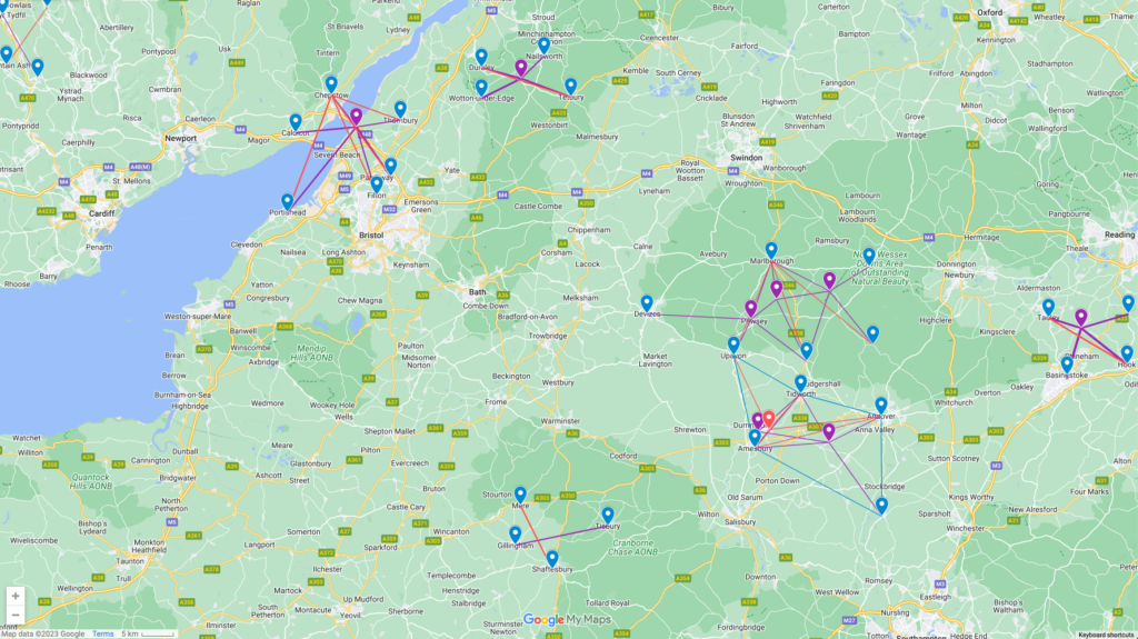
There are some routes you may not want to walk and review right now as they will soon be (temporarily) removed from the website and network. You can see the changes we are making on this map.
Why are changes needed?
A Slow Way is the idea and principle that we should all be able to walk or wheel between neighbouring places.
Slow Ways are represented on our maps by straight lines. These straight lines give the Slow Ways network its distinct and attractive geometric structure. In reality, on the ground, Slow Ways walking routes wiggle through the landscape following our design methodology.
Today’s network was designed by a small group of volunteers back in 2020. They did this by eye, connecting 2,437 places with 6,692 straight Slow Ways.
For the most part this initial effort has been highly successful; we’ve had very few complaints.
That said, we have been gathering and considering suggestions and have decided to make a small number of changes to the network. We are adding some places, removing some places, breaking up a few longer routes and making some new connections.
In some places this will make a big difference to the network. A good example is the addition of Aust near Bristol. This new node in the network will mean people will not need to walk north to Chepstow when walking between Bristol and Newport.
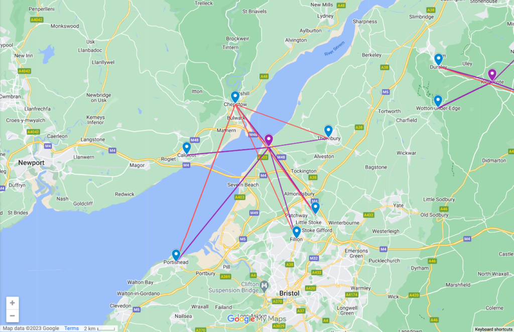
You can see all of these changes on this map. (Please note that it’s a map for illustration purposes – the dropped pin may not be the exact meeting point of each settlement.)
In all we are adding 17 places and 82 Slow Ways. We are also removing 32 Slow Ways.
Cristie has written warning comments on all routes that are affected by this change. You will see these within route reviews.
We have gone through a long review process, and have only made changes where we believe they have value and will have minimum impact.
Longer-term plans
We have plans to enrich the network so that it includes more settlements, has more nodes and includes lots more shorter routes. This effort will make Slow Ways more accessible and inclusive. We have decided that most changes to the network can wait for this effort.
Routes that have been reviewed and are marked for removal will not be lost forever. When we grow the network we plan to reinstate the routes and reviews that have temporarily been removed.
We will send a message in the newsletter and here in Stories once the changes have been made. We’d love for your help to check the new routes and remake any broken connections.
This effort is going to make Slow Ways even better and stronger. I can’t wait to see the network benefit from these changes.
🐌
Sign up to walk new routes here. Stay in touch with the Slow Ways community on Facebook, Twitter and Instagram.