Walking and watching with great excitement as the network gets snailed!
We’ve got some very good news!
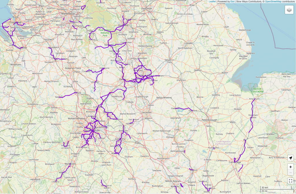
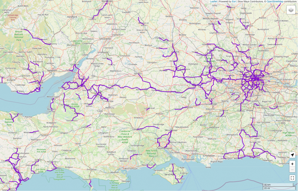
It’s now possible to walk between Birmingham and Sheffield or London and Caldicot entirely down verified Slow Ways routes.

Each of these purple sections have been positively reviewed at least three times. Thanks to the efforts of hundreds of Slow Ways contributors, these two long-distance trails have been walked, checked and reviewed to a standard that will give others the confidence to follow in their footsteps.
The network is coming together!
It was delightful watching as the final routes for each of these trails were reviewed.
A couple of weeks ago we put a call-out in the Slow Ways newsletter asking for people on a number of strategically important Slow Ways routes. One was Shelic three between Shenstone and Lichfield. Another was Marhun two between Marlborough and Hungerford.
Shortly afterwards, thanks to Pilea, Martin, Ken, Hugh and David, the routes were walked, reviewed and verified.
Beaten to the punch
I couldn’t resist and jumped on a train, but on my way to fill the 40km Calne to Hungerford gap someone beat me to the Calne to Marlborough half and I had 20km less to explore. Amazing to feel the network firming up beneath my feet!
I think these trails look incredibly inviting, both to walk and to grow.
Let it grow, let it grow, let it grow!
Here are eight suggestions for taking these trails to the next level.
- 1. Is your local town or city connected to one of these trails?
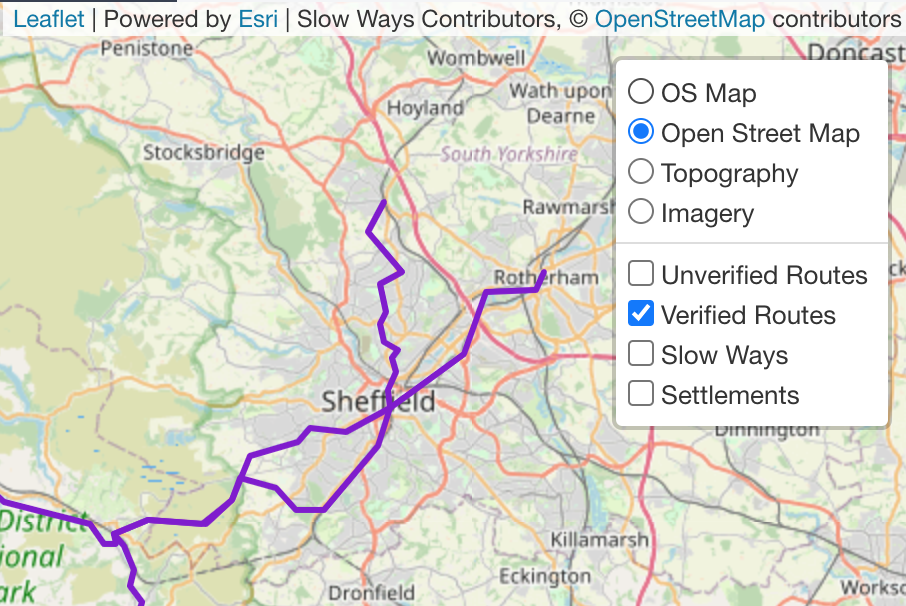
Use the Slow Ways website to see if your town or city is connected in some way to these trails. If not, what would it take to get connected? A good way to check is by using our Journey planner. It’s best used on a desktop (not a mobile) and do be patient as it loads. By clicking on the map layers you can see which routes have been verified.
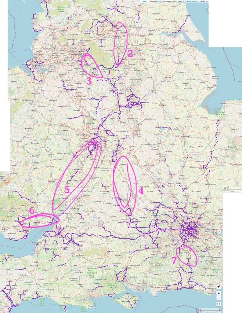
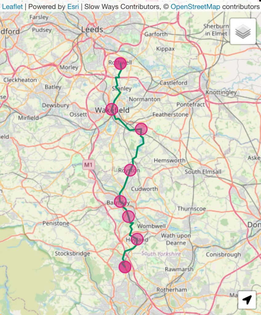
- 2. Connecting northwards to Leeds
Seven routes need checking between Chapeltown and Rothwell to connect Birmingham to Leeds with snailed routes. Most of the routes have already been reviewed at least once. I know first-hand that Worhoy one needs a better route option, but many of the others are good. Check the routes out here.
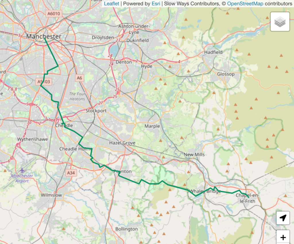
- 3. Connecting the north-west
Just 41km (26 miles) and eight Slow Ways routes need checking, reviewing and verifying to connect Manchester into the Sheffield/Birmingham trail. Each is an average of just 5km. Could you check one of these? Take a look here.
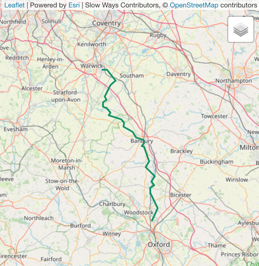
- 4. Are you close to Oxfordshire or Warwickshire?
Banbury is probably the key stepping-stone to us making a connection between Birmingham, Coventry, London and the south-east. Do you know someone local who could target one of these routes?
- 5. Going south-westerly
A trail is clearly forming from Birmingham and Bromsgrove towards Worcester and Chepstow. This would give a route from the north of England to the south of Wales and connect the two verified long-distance trails. Take a look here.
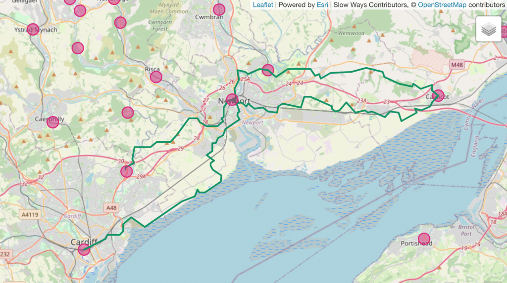
- 6. Caldicot to Cardiff
The route between London, Bristol and Caldicot is very close to reaching Cardiff. There are a few options for making this connection. Take a look here.
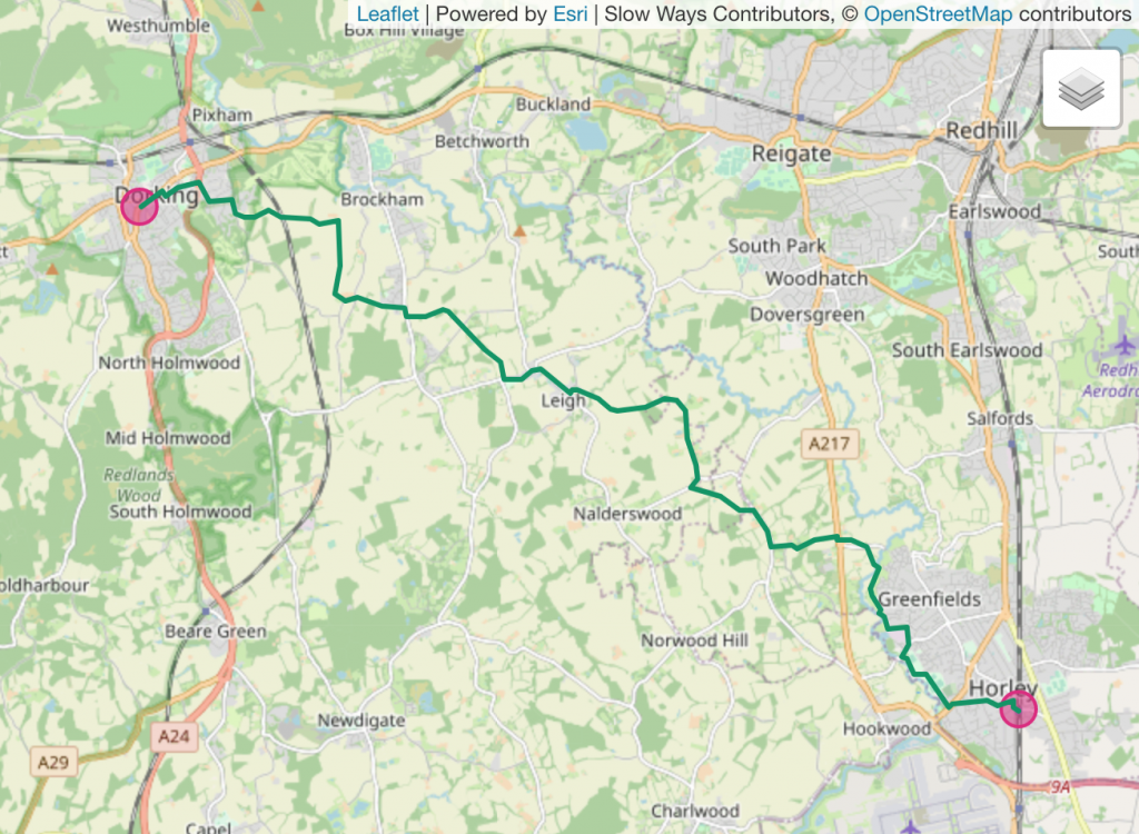
- 7. London to Brighton
Just one route needs to be verified for London and Brighton to be connected. The current target is Dorhor which links Dorking and Horley. It’s been designed by a regular Slow Wayer, so if you are in the neighbourhood, take a look.
- 8. Up for going the whole way?
Who will be the first to try one of these trails in their entirety? It could be a walker, runner, individual or a group. Could it be you?
Join us at this tipping point!
I think we’re close to a tipping point. As these strategically important routes come together in ever longer trails, we’ll start to snowball an even stronger, wider and more inclusive network.
We can achieve an incredible amount over the next few weeks. I can’t wait to see where we get to!
And if you do grow the purple lines in any of these directions, please do let us know on social media or in the comments below. Our hashtag is #SlowWays and we’re @SlowWaysUK on Twitter, Facebook and Instagram. We’d love to know where you are going, how you’ve got on and to see your photos.
Hi! I live about 17 miles west of Cardiff. Is there anything myself and my husband could walk to help link up the Caldecott to Cardiff trail?
Not long distances preferably, I’m not that fit!
Loving the map I got via Crowd Funding, by the way!
Thanks,
Linda
Hi Linda! Thank you for being up for filling this gap. The options are Carnew one or two from Cardiff to Newport, or breaking the journey in Pontprennau and doing two shorter walks – Cardiff to Pontprennau and Pontprennau to Newport. If these are still a bit long you could always do the walks in several sections.
Pontnew (Pontprennau to Newport) has two options and it looks like option two https://beta.slowways.org/Route/Pontnew/9377 amends option one so that’s be the one to do. It has one review already, so if you and your husband walked, liked and reviewed it, it would become verified straight away!
The same goes for Draris, Draethen to Risca two, which is only three miles! https://beta.slowways.org/Route/Draris/9824