A giant citizen initiative is underway, and we need you! Read on for how you can help us, and we can help you
What if there was a network of recommended ways for walking or wheeling between any town, city or national park in Great Britain?
That’s what we’re creating – and we’d love your help with that.
Working with volunteers across Great Britain, and with support from the National Lottery Community Fund, we’re crowd-sourcing a national network of walking routes that make it easier for people to walk or wheel between places.
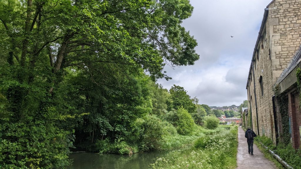
When driving or catching the train somewhere there are lots of good websites, apps and services to help us find our way. Despite having a rich footpath network across much of Britain, the same can’t be said for walkers and wheelers. Ordnance Survey maps do show lots of paths, but they don’t show which are the best to take.
Councillors and council staff are in a unique position to both benefit from Slow Ways and bring it to life. In this article I’ll explain how.
Multiple benefits
Walking is a big priority for councils, authorities, governments, national parks and national landscapes across Great Britain.
It’s not surprising. I’m sure you will be able to see links to how Slow Ways support multiple overlapping agendas, plans and ambitions for your council and communities, not least:
- Health and wellbeing
- Active travel
- Climate change
- Cost of living through affordable transport
- Levelling up and spreading investment
- Tourism, leisure, culture, heritage
- Accessing nature
- Planning
- Quality of life
…all by going for a walk!
Slow Ways is a beautiful and positive initiative that people from across the country can both contribute to and benefit from. By helping with Slow Ways your community and council will gain a walking network that connects it to your region, nation and the rest of Britain.

Our solution
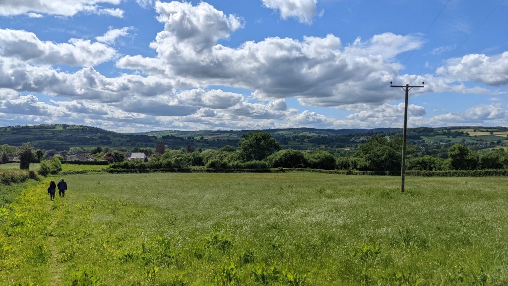
Sharing easy-to-follow and trustworthy routes is an important solution. People are far more likely to use inviting routes that have been recommended by other people.
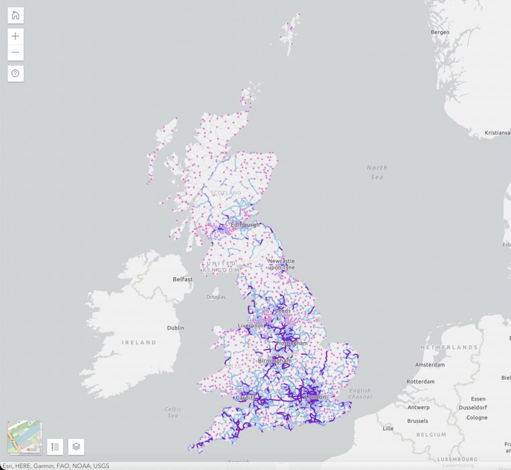
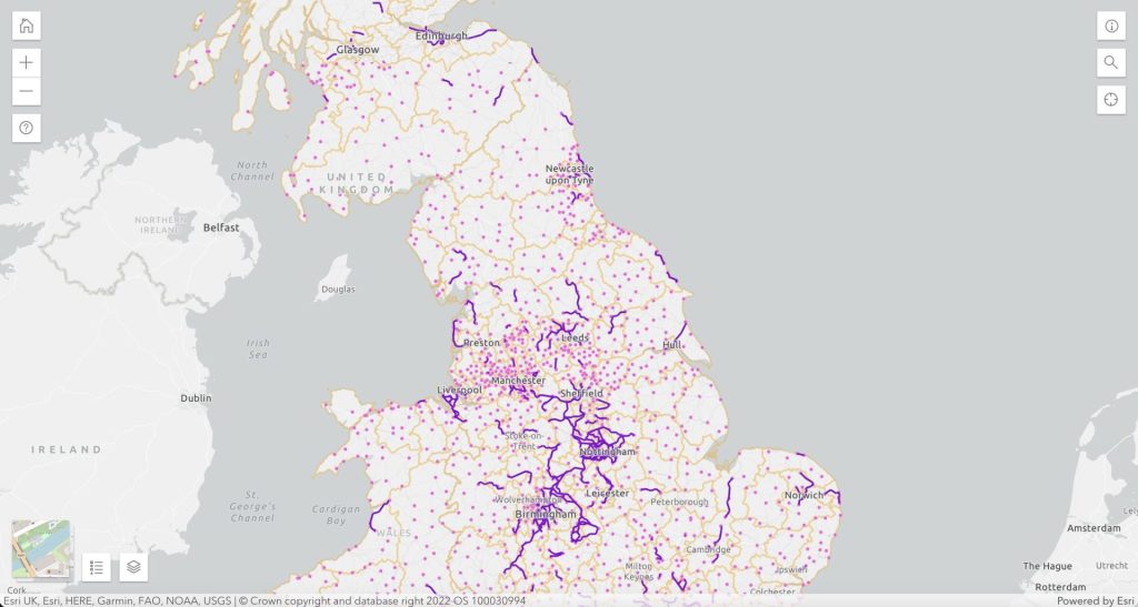
People have already drafted over 8,500 routes, each of which connect two neighbouring towns, cities or villages.
Each Slow Way route in the network has been suggested by a volunteer. To create a fully verified and trustworthy network we need to walk, review and survey all the routes to make sure they are good enough to be included.
Our current challenge is to get outside and triple-check all of the routes.
Here’s how we’re getting on with that:
- 8,622 routes
- 126,021km of routes
- 50% of Slow Ways reviewed
- 12% of Slow Ways verified
- 80,104km of reviews shared
- 1 million words of reviews
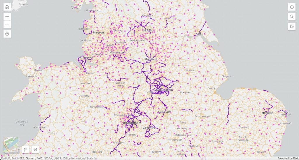
Nottingham, Exmouth, West Kirby and a few other towns have already 100% triple-checked all their routes. Dozens of towns and villages are just one walk away from hitting that goal.
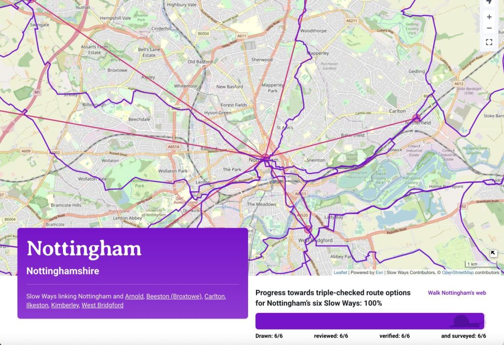
You can find out how close a town is to hitting that goal by searching for it on our homepage. Glasgow is on 61%, Cardiff 67% and Brighton is at 80%.
The power of local councils!
Once people in every town, city and village in the network have checked their local routes – hey presto – we’ll have created the network! It’s all about local people checking their local bit of the network.
Councillors and council staff have extraordinary collective potential to come together to make a big difference to this national citizen initiative.
Slow Ways routes connect council areas across the country:
- 100% of nations and regions of Great Britain
- 100% of counties
- 100% of local authorities
- 100% of Westminster constituencies
- 100% of national parks
- 92% of wards have a route passing through them
- 8 in 10 community and parish council areas have a route passing through them
- 1 in 4 wards have a Slow Ways node (settlement)
With this coverage, councils and local authorities are in a unique position to help with Slow Ways. You collectively have the power to create the network in a single day!
Imagine that – all councils across Great Britain collaborating to create a national walking network in a matter of days. How inspiring would that be?
Even if it actually takes a few months… it’s totally possible, if everyone does their local bit.
From Clackmannanshire to Frome, councils have already been showing their support for Slow Ways by passing formal motions of support. You can read more about this here.
How you can help
This is a massive ambition, but many feet can make light work.
Councillors and council officers are already one giant team for Britain. Could your council community chip in and check your bit of the network?
Here’s what you need to know.
There are 2,433 towns, cities and villages in the network. We want all of these communities to have a complete set of Slow Ways route options that are 100% reviewed, verified and surveyed. To become verified a route needs to get at least three positive reviews.
To help you could get together:
- 3-4 people to review, verify and survey all of their community’s routes over a small number of days, or
- 10-30 people to split up and check all of a community’s Slow Ways in a single day
You could also connect with your neighbouring councils or communities at the end of each route to join in too.
Taking part will be rewarding, enjoyable and memorable.
Routes and route data will always be accessible to the public for free. We are creating open infrastructure for public good.
Take part during the Great Slow Ways Waycheck
This summer we’re going to be kick-starting a new tradition for the country – the Great Slow Ways Waycheck. Partially inspired by ‘beating the bounds’, this will be a midsummer sprint to check as many routes as possible. Taking part between the 16th and 25th of June when days are their longest, this could be a great time to get involved. You can of course help with Slow Ways at anytime of the year!
Sign up and help connect your community
We’d love for you and your community to be involved. To help, simply choose, walk and review your local routes.
If you sign up we’ll know that you are helping and will be able to keep you updated and share both resources and opportunities with you.