Who’s up for an epic summer holiday walking challenge?
We’ve had an idea that we’d really like your help with.
We love creating routes that people can follow. We also love our national trails and national parks.
So we got thinking… what if we used Slow Ways routes to create a mega-trail that connects all of Great Britain’s national parks? Wouldn’t that be an amazing thing to design and, maybe, for people to follow? So, let’s have a go!
The trail will connect all 15 national parks, Great Britain’s first National Park City (London) and numerous Areas of Outstanding Natural Beauty and National Scenic Areas. Once completed it will likely be over 3,500km (2,100 miles) long. That’s a long way – and what an amazing hike it will be! Walking and checking routes through and between the most beautiful parts of Scotland, England and Wales? What a perfect mission for summertime weekends, long days off, or holidays in national parks.
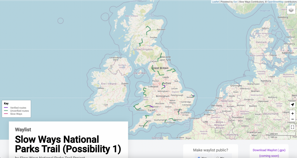
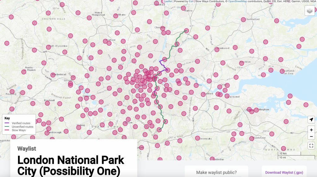
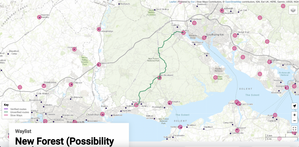
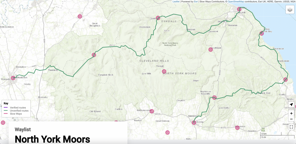
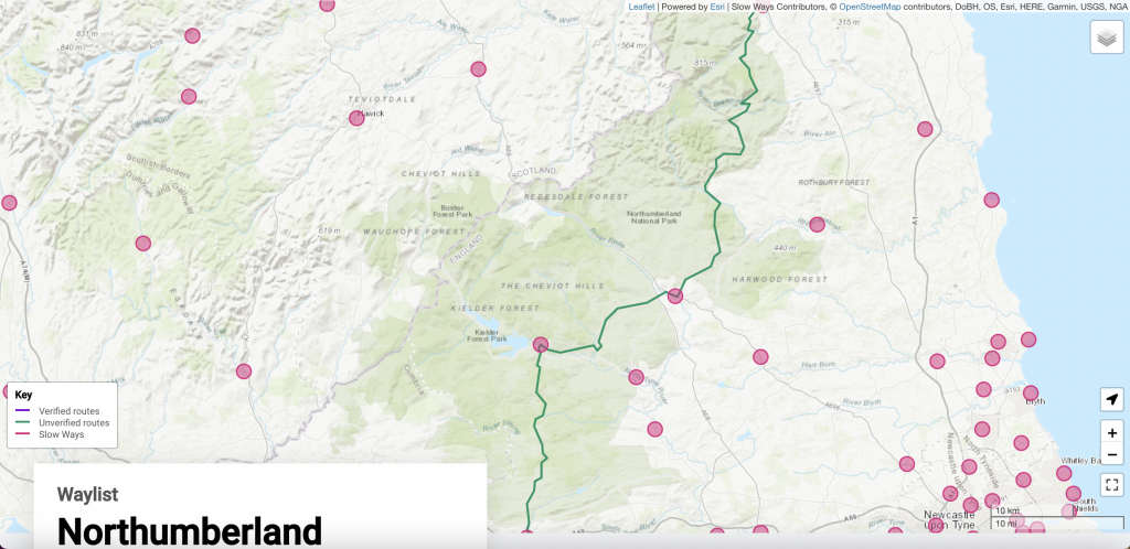
It could look something like this:
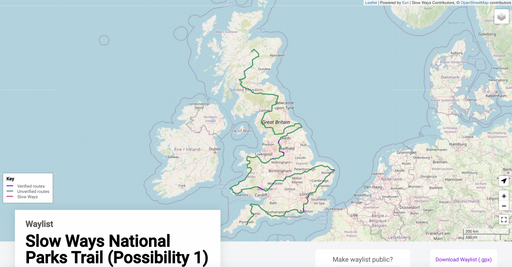
Such a trail could go many different good ways, and we’d love to know which way different people think it should go, especially where they have local knowledge or experience.
Up for helping?
The Slow Ways National Parks Trail will use the Slow Ways network. This means the trail will benefit from the Slow Ways methodology, we will be able to rapidly design the network and the website will help people to walk, check, review and improve routes.
Here’s the step-by-step plan and how you can help:
Step 1: Where should the trail connect?
Do you have good knowledge or experience of one or more of Great Britain’s national parks or the stretches in between?
1. Scroll down and take a look at the trail possibility maps below. Do you know of a better way? Perhaps a way that is more enjoyable, sensitive, accessible, safe, has better transport links or fits the Slow Ways methodology in another way.
This is a game of dot-to-dot to decide which places should be connected by the trail. We are not asking for feedback on where individual routes should go, but deciding where in the network should be connected to create the trail.
2. Create a waylist of your route suggestions. You can make a waylist using our Journey Planner. You can see how to use the Journey Planner to make a Waylist in this video.
Please create separate waylists for each national park or each section between national parks – that will make it much easier for us to analyse everyone’s suggestions and comments. Make sure the Waylist is set to “public” so we can see it.
3. Submit your waylist of suggestions through this simple form.
All suggestions should be with us by midnight on Sunday July 3rd.
Step 2: We’ll re-draft the trail
We’ll look at everyone’s suggestions and draft a new trail, based on where most people think the trail should go, and levels of local knowledge and experience.
Once drafted, we’ll contact everyone who’s submitted ideas for any final comments.
Step 3: Hiking and checking
Hiking and checking – this part is very important and very ambitious! Every route in the trail will need walking, reviewing and verifying. In some cases new route options will need to be added to the trail and they will need to be ground-truthed too.
In all, there are likely to be over 200 routes that will need checking. Some will be under 5km, but as the trail will go through some tough open country, a few may be over 50km.
You might check one small section or be up for walking 100km across an entire national park. It will all count.
Step 4: The grand prize!
Once done, we will have collectively created one of the longest and most incredible trails in Great Britain. Whether you plan to walk all or part of it yourself, it will be a wonderful thing to have created and gifted to the country… and just possibly, we could have designed, walked and checked it within a single summer. A super-ambitious, 2000-mile, 3500km, brand-new, crowd-sourced monster-trail. That’s the length of the Appalachian Trail! Or the England and Wales coast paths put together!
Possibilities possibilities possibilities!
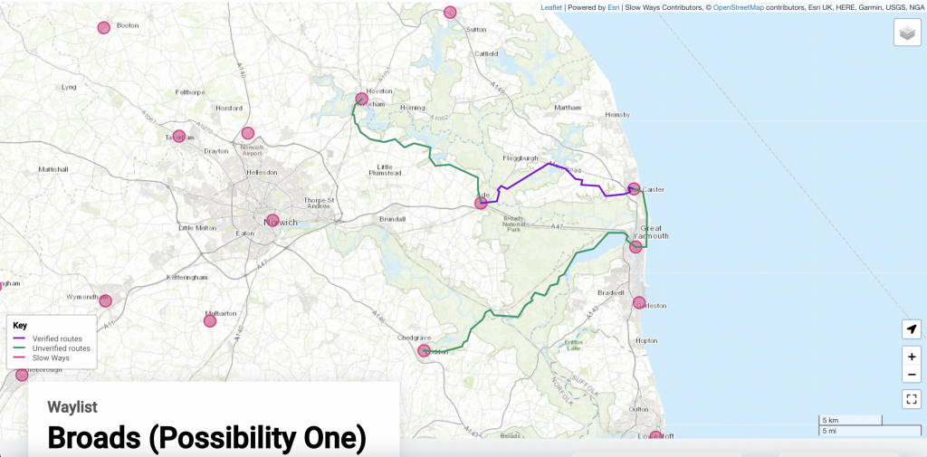
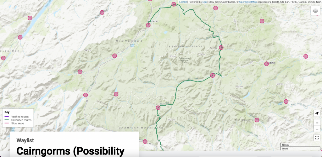
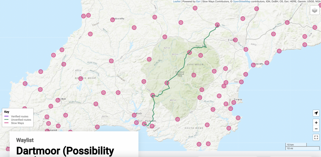
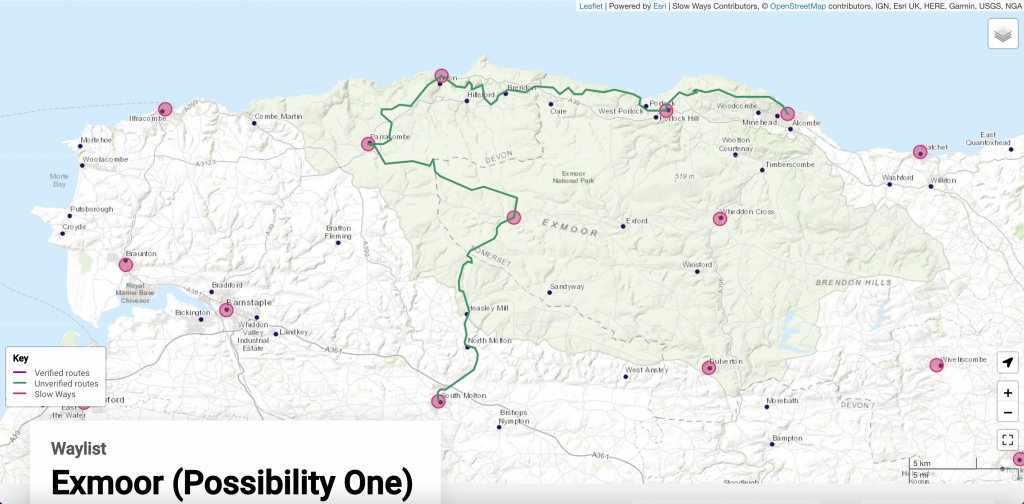
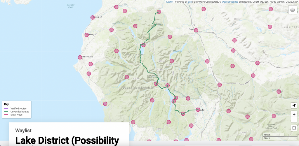
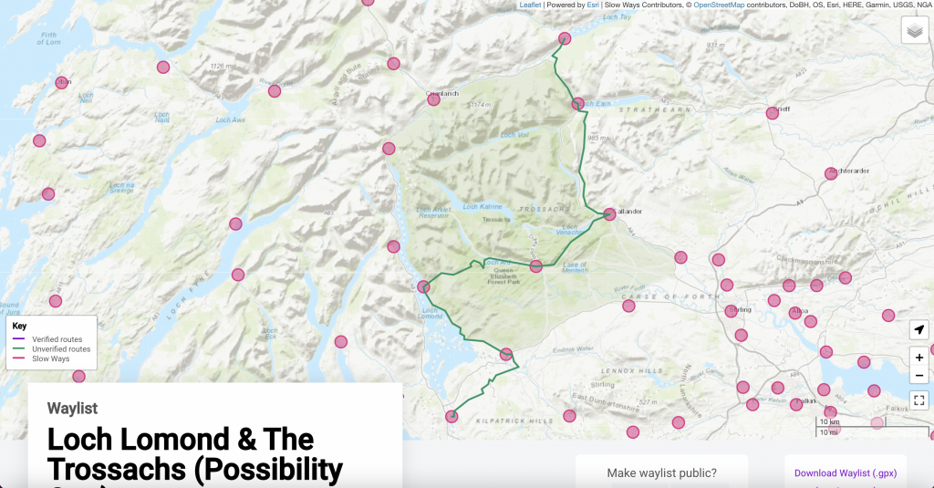
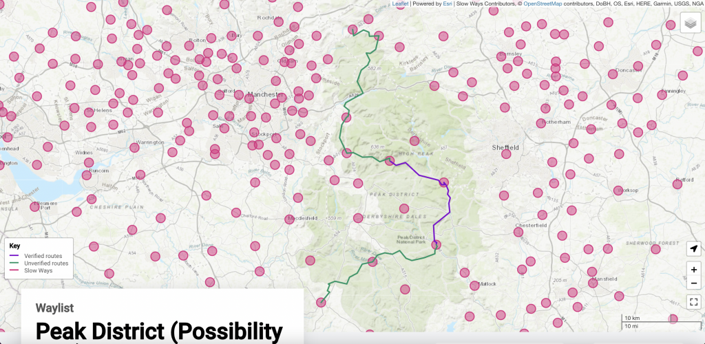
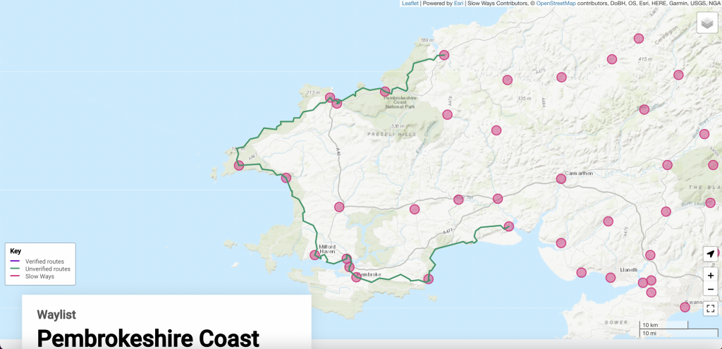
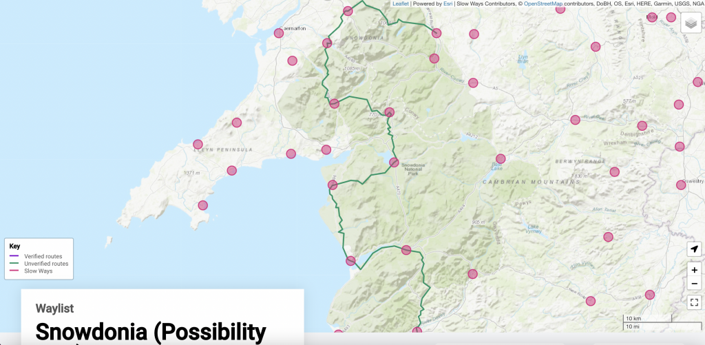
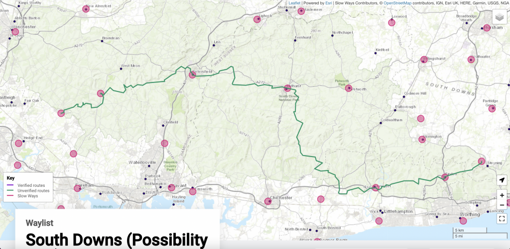
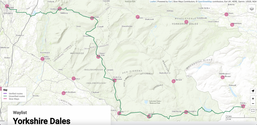
The maps below show a set of possibilities for where the trail could go.
Click on any of the maps to see their waylist maps on the Slow Ways website.

If you are creating a waylist of better ways, please start/finish the routes on the same sides of the national parks as we have. You don’t have to use the same settlements, but if we are showing that the trail will connect into a National Park from the north, south, east or west, please do the same so that we can make it all join up!
Start/finish sides: Brecon Beacons (East/West), Broads (North/South), Cairngorms (South/Any other), Dartmoor (North/South), Exmoor (East, South), Lake District (North/East), Loch Lomond and The Trossachs (North/South), London National Park City (South/North), New Forest (West/East), North York Moors (West/South), Northumberland (North/South), Peak District (North/South West), Pembrokeshire Coast (North East/South East), Snowdonia (North/South), South Downs (West/North) and Yorkshire Dales (West/East)
This is a really exciting project. Please do contribute by sharing knowledge or a walk and let’s see what we can make before the end of the summer!
The route through the South Downs National Park should follow the whole of the South Downs Way then follow the adjoining Wealdway towards Gravesend and en route joining the London Countryway (ferry across the Thames at Gravesend) and then continuing on to join the Green Corridor which is your Possibility route north of London I think. This avoids London completely.
Hi John, thanks for the input – it sounds like you know these trails well? We’re looking to create a route made of Slow Ways all joined up end to end, and I’m not familiar with the routes you mention so I can’t see at a glance how much of the Slow Ways already make use of these other trails, although I bet there’s some crossover – can you tell from looking?
Interesting to consider avoiding London already too – I can tell without asking that Slow Ways’ Dan, who has drawn this provisional wiggly line, will have included London on purpose, as one of his other babies is the National Park City project, of which London is the first. https://www.nationalparkcity.london/ The hope is that the London Slow Ways feel green and lovely enough to feel worthy of the inclusion – but there’s always room for improvement!
Loved the idea. Fantastic initiative
Thanks Martin!
Hey I walked landsend to jon o groats and linked up the SouthWest Penninsula voast path, Offas Dyke, The pennine way West highland way,
Its 1300 miles in total..
Ive also trekked from Eastbourne to Bath which links up the South downs way to Cotswolds way.
Ive been doing this kind of thing for years message me if you need help or a bit of research, even some legs….
Hey Julian, your walks sound fantastic. We definitely do need your help! And legs! Would you consider commenting on the potential routes above via this form? https://docs.google.com/forms/d/e/1FAIpQLSdpSzUNb88qLjVAvAWeS4BG33XuOVFYKVAyFlWAtixMwhupwA/viewform Remember that our mission is about creating a trail made out of Slow Ways. In many places the Slow Ways will incorporate bits of other trails which is great, and in places maybe they should be tweaked to make more use of these trails, but our core job is testing short(ish) routes that connect cities, towns and villages. This monster trail is made out of those shorter hops.
Oh, well done for completing a national trail Lejog. I’ve done Chepstow to Inverness, but covid has delayed doing the extremities so far. Interested to know how you went from north Wales to PW (I went Chester to Diggle – mostly following canals), and also which route from Kirk Yetholm to Milngarvie ( I went Jedburgh, Galashiels, Peebles, Biggar, Clyde valley – the usual suggestion is to head more NE).
Great idea – good to be involved even in a small way!
Thanks Maggi. Many hands! (and feet…!)
TOTALLY IN LOVE WITH THIS IDEA. Just at a turning point in my life, where me and my husband are selling everything to become nomads / tramps / vagabonds. We are planning on trekking and wild camping for 9 months of the year and coming back to a caravan over the winter months to recoup / work like hell to save for the next years adventures. This sounds like it would see us right for fair bit
Shelby – what a brilliant life-juncture. We have a new routing feature coming up on the site where you’ll be able to input any two places in the network and it will create a long trail between them for you – sounds like that could keep you going for years! Keep us posted!
Hi All,
This joining up of Nat Parks is a great idea, but I would have like to seen you joining up all the AONBs as well.
I would also love to have seen the route start at The Lizard (southermost tip of the mainland) and end at Cape Wrath (nornermost tip of the mainland)
Cheers Mike
Hi Mike, great minds – we did think about it. There are 39 AONBs in England and Wales, and 40 National Scenic Areas in Scotland, and we considered it but thought that the route might just be unworkably long and wriggly… Perhaps we could add offshoots over time, like B-roads leading in to this A-road trail? I love the Lizard-Cape Wrath additions – would you like to suggest them by creating a waylist for each end and submitting it via this form? Cape Wrath itself isn’t one of the network settlements, but Durness is on there. https://docs.google.com/forms/d/e/1FAIpQLSdpSzUNb88qLjVAvAWeS4BG33XuOVFYKVAyFlWAtixMwhupwA/viewform
Hi Mike! Great idea. I did design one of these. Like Hannah says, it’s SO big it’s another concept really. We are just updating some of our tech so the route will show (as it’s so long!), but I’ll make sure I share what I drafted when we can. Maybe we could do the NP + AONB as another trail next!? Or perhaps Hannah’s idea with off-shoots is the way to go.