Slow Ways tech team Darren and Joao just released some exciting new functionality: please welcome ‘routing’! Just type in two places and the site will give you the most direct route between them. Plus, they invented teleporting wormholes in the process… Let the big dreams begin!
Hannah: Darren, chief technologist of Slow Ways, I hear routing went live on Wednesday. What is routing?
Darren: It’s the manifestation of our vision! I’ve been blown away by the quality of the routes inputted in the first place, and they’re being reviewed and verified day by day. The network seems to be working really well, so we did some experiments to see if we could join the routes together.
I like daydreaming about travelling, and like to put in Timbuktu and see that Google says it’s 900 hours to walk there, and think ooh! But Google walking routes are famously not great – they’re created automatically, whereas ours are handmade. So now you can do the same on our site, and put in your starting location, and Aberdeen or Truro or anywhere else in the network, and see how easy, or difficult, it would be to walk there.
And thanks to the idea of connecting settlements you always know that at the end of each Slow Way there will likely be somewhere to rest, to get some food. Especially as people have added place surveys too – you can see if there are toilets, cafes, etc. Routing is a very big stepping stone to realising our dream of a continuous walking network of the country.
Hannah: Was routing rooted in the original idea? You always knew this day would come?
Get your geek on!
Darren: We always did want to do it, but we thought it was a long way ahead, with proper step-by-step instructions – and we need to have the network really nailed down to get to that point. But I spoke to some academics in a London university, and also an agency called Diagonal, and they suggested that we used a crowdsourced Python language software package called Network X. It’s a clever library really, that is used for all sorts of things, from this visualisation of drug interactions, to this aeroplane flight analysis, to looking at social networks like this example of a karate club splitting into two! Get your geek on!
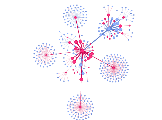
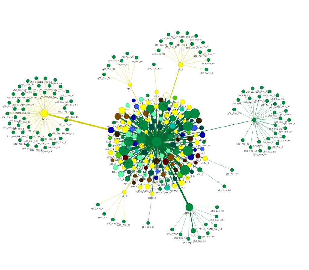
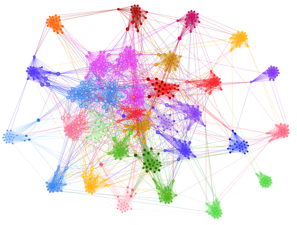
A network is simply a collection of connected objects, and they are highly useful for modelling relationships (aka edges, eg routes) between entities (aka nodes, eg settlements). Here are some pretty ones! Image used under pyvis BSD License
It’s used to create and manipulate networks. So we loaded our network into it, and it has the ability to work out a score to get from A to B, and then it works out the lowest score to get from A to B to C to D to E, and the series of connections with the lowest score is then the most efficient way to get between two places.
Hannah: With efficiency being…?
Darren: Shortest, quickest. And we can quickly see that there will be some options we can add in – the flattest route, the most picturesque route – and that will tie up this early stage of routing. And then later on we will be able to develop routing people from and to the start point, from your house to a settlement start point, through the network and then out again to your destination – a football game, a friend’s house. And also routing to the closest point of the network too rather than having to start at a settlement.
Hannah: And the step-by-step?
Darren: Probably a year away. And that’s where everyone comes in, because if you take a route that isn’t very well plotted in the wild, if you plot it more accurately that will help get us to that point. And we’re also talking to our mapping partners to get more data that will help with the accuracy we need.
We’ve got the Apple iOS app in early beta (testing), and that can send our routes to Apple Maps and Google Maps for turn-by-turn directions as well, so then Slow Ways routes can come through their functionality.
Dream corridors
Hannah: So what can people do today that they couldn’t yesterday?
Darren: They can get a whole chain of routes recommended, to get between any two places on the network. What we would really like people to do is to think about corridors. Say you live in London and you want to get to the sea, you can ask for a route from, say, Kennington to Brighton. Then the route will show you if each section is verified (verified routes show up purple), and there might be a couple of routes not yet verified, so we’d love it if people then walked and reviewed those to fill in the gaps, and then we’ll have a continuous verified route from London to Brighton, that other people can use. And that’s really useful!
Corridors are a tactic to make the network more useful at this early stage of it – to get some stretches verified so people can trust them, and people who aren’t confident in pioneering routes can start using the network too.
Hannah: So people use the routing, then save it as a waylist?
Darren: Yes. Then you can name the waylist and make it public. Go wild! If you could go for a walk anywhere in GB where would it be? Then you can go into the individual routes and see the photos and read the reviews and see what it’s like.
Coming very soon you’ll be able to download a single gpx file for a whole waylist too, so that will be good.
Hannah: And we already have people doing this with combining routes end-to-end – Tim Ryan and his 19 routes from Cardiff to Aberystwyth, and Ingrina doing 15 routes to take her from London to the South Downs.
Darren: Yes – we saw the users doing this and thought we could help really, as a time-saving thing. Historically if you wanted to plan a walk from London to Cardiff it would take an hour or two to pick all the routes. Now it’s a millisecond! And if you want to tweak it from there you can do that in waylist, and have a diversion to your friend’s house or whatever.
Hannah: It’s really exciting. I sent the testing page to a friend a few days ago and within minutes he had got it to make him a route from Lowestoft to Porthcurno – the furthest east to the furthest west of our places in Great Britain, which turned out to be 500 miles / 800km and 59 routes. Within minutes he’d seen that it’ll go through his mother-in-law’s village, and he reckons it’ll take him 23 days, and he’ll do it east to west so as to be fit by the time it gets hilly – it’s such a great tool. It wasn’t just daydreaming either – within a few minutes it was part of his future landscape.
… So what’s this about wormholes?
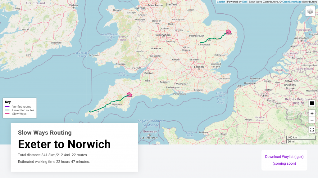
Darren: When we started testing it we discovered we’d created a teleporting machine. When I routed from Exeter to Norwich the route happened to include a place called St Ives of which there are two. The route went southwest to the one in Cornwall and then popped out of the one in Cambridgeshire, saving you several hundred kilometres of walking!
Today’s release also includes an estimate of the time it’ll take to walk your route, so for me to walk from Exeter to Ealing Broadway will take 81 hours and 21 minutes! That’s assuming 5km an hour, and we’ll be adding another algorithm that calculates that each 10m of elevation costs you one additional minute. It’s called Naismith’s Rule, I just learned about it yesterday.
Hannah: And on your own fantasy list?
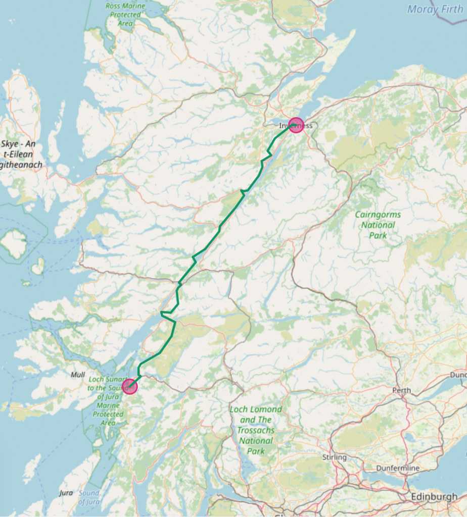
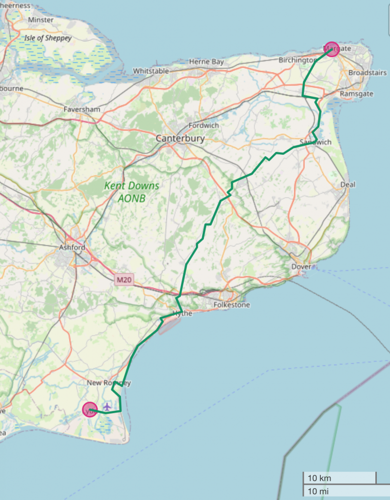
Darren: My friend and I are talking about that Inverness-Oban route, the Great Glen Geological Fault. And I love the Lydd-to-Margate art trail. And the epic C2C route of Workington to Whitby, that I cycled already. It goes through Nenthead, one of my favourite places in the country, home to the London Lead Mining Company, who used to hold parties in the mine!
And I’m also walking London to Reading with my wife, we’re doing segments. We’re about three-quarters of the way done actually, so then it’ll have to be Reading to Bristol.
Hannah: Stretch goal!
Darren: There’s something really beautiful in the fabric of Slow Ways that means walks always go urban-suburban-green-rural, and then you start getting a bit of suburbia back, and then urban again, in cycles. Doing a longer walk made of these shorter segments, it’s useful, varied.

/ Leaflet | Powered by Esri | Slow Ways Contributors, © OpenStreetMap contributors
On the shoulders of giants
Hannah: And all of this made possible by people power.
Darren: Yes! Network X is a free open-source Python library, and we did some work on making it run really efficiently, so our whole network is stored in memory and you can get a route back in milliseconds. And if anyone else would like to use our network for anything, let us know!
Behind all of these things we’ve built APIs – application programming interface – so it means that we can use our app, and it draws information from the website and the website draws information from the app. But we plan to publish the APIs to the public so that people can use our functionality for other things. We never know – just as we are using other people’s APIs, like Ordinance Survey and What Three Words, and the weather beta, we’re going to publish all of our APIs so people can put them into their projects.
Hannah: So everything you are doing is more than just saving people a bit of time – it’s adding something to… humanity, isn’t it? It’s meaningful!
Darren: Er, yes? But it comes back to the fact that the dream was to have a walking network and now we have one – we’ve actually done that very quickly! It’s not 100% verified yet, but it works bloody well!
Hannah: And how long did routing take?
Darren: It took a lot less time than we thought! There’s nothing impressive about those stats! When I had covid and therefore a bit of time inside, I’d just spoken to the people who had recommended Network X and I wondered how difficult it would be. It took me about a day to get something that was good enough to show to Dan. And sadly… or amazingly… it’s just fifty lines of code.
Hannah: Fifty lines of code…
Darren: Because we’re standing on the shoulders of giants, really. It makes it sound not very sophisticated…
Hannah: No, I think it’s nice, isn’t it? That Slow Ways is a network of routing and mapping and how people move through space, but also a networking of people with visions, behind screens, building on each other’s work and ideas.
Darren: Yep, yep. I like that.
Hannah: It’s a good last line! Thanks Darren!
- Try out routing here! We’d love to see your dream routes – put your ideas or links to your routes and waylists in comments below! Who might you walk to? Meet someone in the middle?
- Is this the longest route Great Britain can field at 1111 miles, 1789km? (You do get to do a fair chunk by ferry…) How about furthest east to furthest west?
- Please do screen-grab your dream routes and share them far and wide! @SlowWaysUK on Twitter, Facebook and Instagram, and #SlowWays so we can share your big ideas and bucket lists.
Hi Fantastic interview thank you.
I plan to walk the Mary and Michael line up to Tiverton then break out accross country to Canterbury in a St michaels mout to Canterbury Pillgrinage in September. the Tiverton to Canterbury was easy – one waylist, but compiling a close match to the mary and michael line was a jump by jump process. I now have a fragmented waylist that i would love to publish but need to organise. Is there a way I can line them up without deleting them then re adding them in sequence? If I did would the waylist automatrically recognise the consecutive routes?
My immediate project is to walk a (new?) “local web” based around nearby St Blazey in Cornwall. Where routes are questioned I have posted in village FB and Whatsapp groups to find out what has happened (used to be a permissive way through the chapel but now someones garden for example) – this has raised interest in slowways too 🙂
Hi Julia, thanks for the super rich reply! What an epic trip you have planned. I hope you’ll keep the whole Slow Ways community posted about it when the time comes. I’d love to ask you more about it. Are you doing it as a pilgrimage? Thank you for championing the St Blazey web mission – local groups are such a fount of knowledge.
We are working on a drag-and-drop feature for the waylists so that you can do exactly that, but it’s not ready yet I’m afraid. It’s good to know it’ll be useful! Deleting and starting again is the only option at the moment. Kindly tech man Joao has offered to put yours in order for you though, behind the scenes. So if you publish it and put the link in a comment I’ll pass it on! Cheers, Hannah