Secondary geography teacher? Thank you for finding this page. We’d love for you to be part of Slow Ways!
Slow Ways is a giant citizen geography project to create a national network of walking routes that connect all of Great Britain’s towns and cities, thousands of villages and every national park.
While we do already have a footpath network, Slow Ways is about people sharing trusted recommendations of the best ways to get from one place to another. By collaborating, we can make it easier for people to imagine, plan, enjoy and share walking journeys.
Why create Slow Ways?
Ultimately, we are doing this because we want to inspire and support more people to walk and wheel more often, further and for more purposes. This will have multiple benefits for individuals and communities alike.
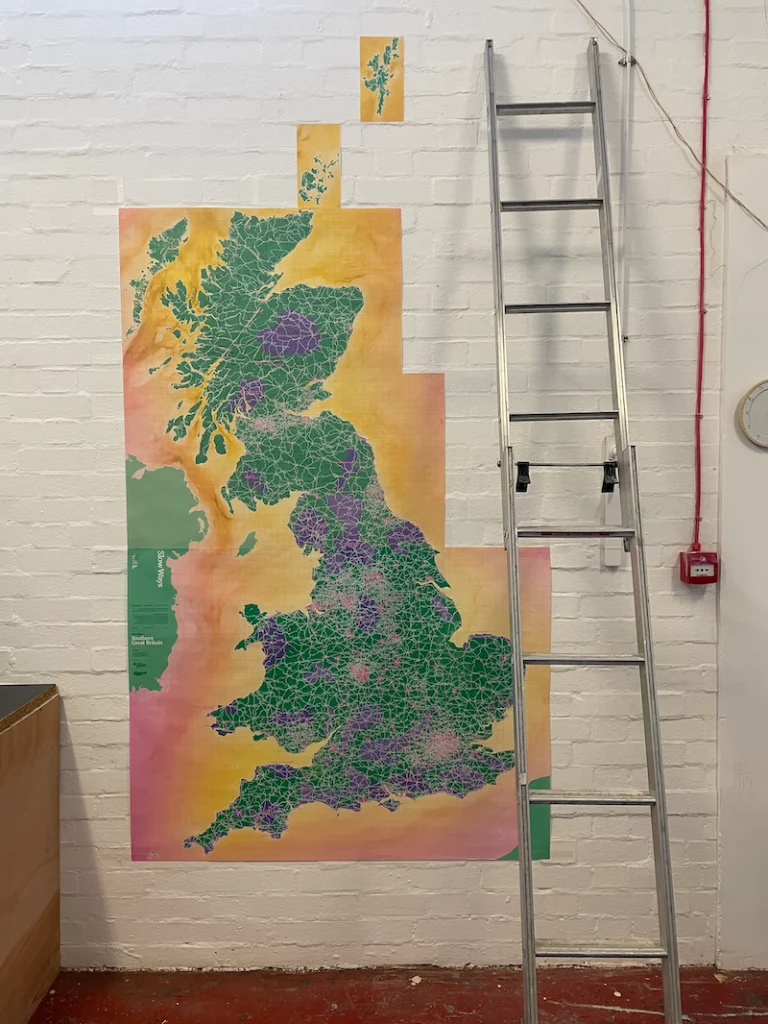
You can see how we’re doing that both on this website and also on this giant map that we are crowdfunding to print. Schools can request free copies of the map, so do click through and scroll down to register for that!
As a geographer and a teacher, you are in a great position to help make Slow Ways a success.
On this page you’ll find lots of ways you can get involved with Slow Ways both personally and professionally, that have been developed in collaboration with geography teachers Alan Parkinson, Claire Kyndt and Kate Stockings. We’d love to see anything you do with pupils and students, so do contact us (hello@slowways.org)!
Get involved personally
Sign up – Sign up for an account. That way you’ll be able to keep track of routes you’ve walked, share route reviews and create collections of routes called waylists.
Walk and review a route – There are over 8,000 Slow Ways routes that need walking and reviewing. Some are short and urban. Others are more remote and challenging. Whatever your preference, you can contribute to Slow Ways by simply walking and reviewing a route. Choose a route, and then:
1. Walk or wheel it
2. Review it
3. You’ll find a how to guide here.
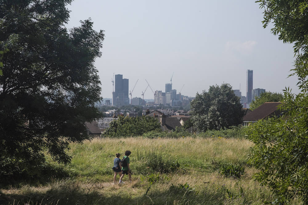
Walk your local web – Challenge yourself to explore a local area by walking its Slow Ways web, like this one for Bristol.
Connect with us on social media – We’d love to share any Slow Ways journeys you go on. Connect with us on Twitter, Instagram and Facebook.
Go on an adventure – Use our Journey Planner to plan an adventure. Check out this journey, designed using the journey planner, that Slow Ways volunteer David Sanderson is completing between Brighton and New Brighton. David’s been completing this journey over many months. Where might you go?
Get involved as a team
Hold a walking departmental meeting – Walk a Slow Way as part of a department meeting, training or team-building day. You could use it to get to know the geography of your local area better while having creative conversations.
Meet halfway – Organise to meet a geography department from a school at the other end of a Slow Ways route. Go for a walk and meet halfway. Explore ideas for collaboration.
Teaching with Slow Ways
Slow Ways is an idea, network, initiative and a website. You can teach about Slow Ways as a concept and case study, or physically use the routes for learning outdoors.
It’s important to note a couple of things. Firstly, not all Slow Ways routes will be appropriate for walking. Many are yet to be checked and reviewed, so they may not be safe to walk. Some are too long or will be too challenging. Where you can’t use whole Slow Ways routes in your teaching, you could use parts of routes or other paths.
Secondly, the Slow Ways website can be used by anyone, but to sign up for an account students must be aged 13 or older. If they are at least 13 but under 16 years of age, a parent or other adult authorised by a parent may create an account for them to use.
Here are some ideas for using Slow Ways with students.
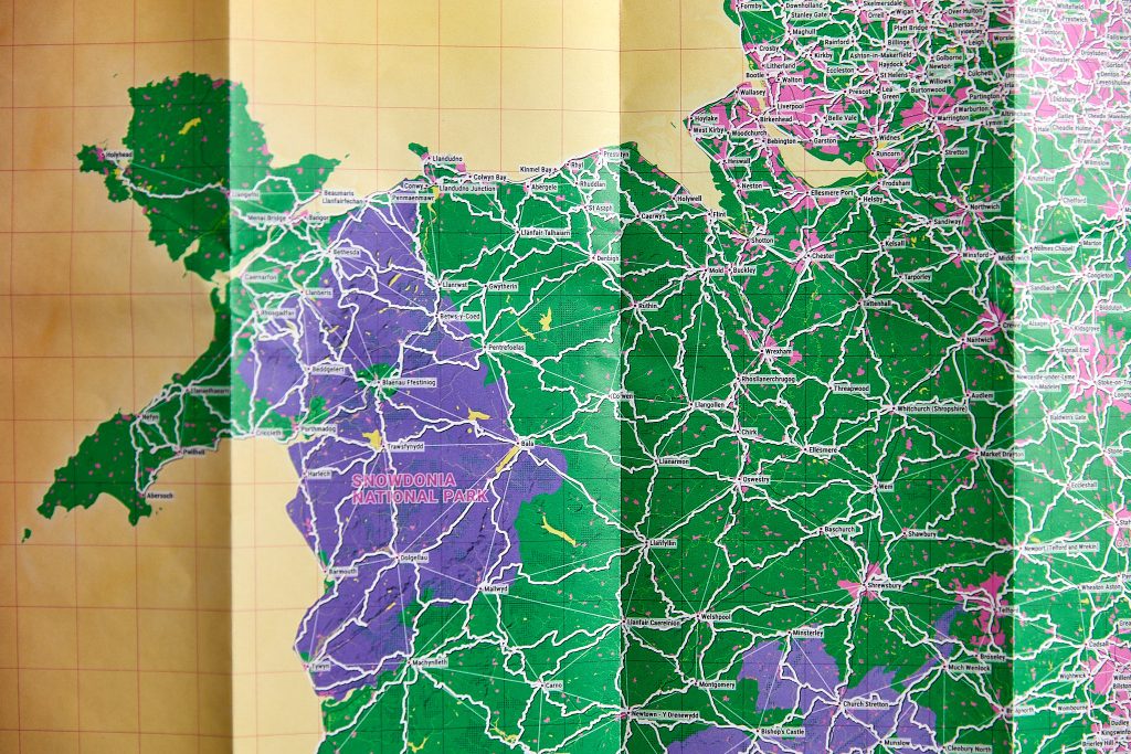
Get a free giant Slow Ways map of Great Britain – Register to get a massive map of Great Britain’s Slow Ways walking network. It’s a brilliant learning resource, perfect for planning journeys, and it looks great on a wall too. The map is the size of two OS Explorer map sheets. Find out more and register here.
Slow Ways as a case study – Teaching about Great Britain’s road, rail or other networks? Why not use Slow Ways too? You can read about the methodology for how the network was designed here. You’ll also find some videos about Slow Ways on YouTube.
Plan a multi-day hike – Use the Slow Ways website to design a multi-day hike between two places in the country. Where would you go? Why? What would you need to take with you?
Capture a route in nine photos – Walk a route or path and record what it’s like in just nine photos. How are your photos different from other people’s?
One path, same places, two stories – Write a story about the same path, but from the perspective of two different users. How can the same place be experienced in different ways?
Design a wayfinding sign – People are used to roads having signs that make it easy for car drivers to find their way around. Footpaths do not have the same quality of signage. Design a signage system that could help people find their way.
Do a cost benefit analysis – Weigh-up the costs and benefits of walking between two places compared to other forms of transport.
Who could wheel the furthest? – Pick a place on a map. How far could you travel by wheelchair on paths before being blocked by some kind of a barrier? Draw a map that shows where you could get to.
Suggest a new path – Where would a new path make walking safer, more accessible or more direct? Research a good location and then suggest it to a relevant decision-maker.
Google Maps vs Slow Ways – Google uses algorithms. Slow Ways is based on recommendations from people. Investigate which is better at designing routes.
Extreme routes – GIS analysis – Download 10 different Slow Ways routes. Use GIS to analyse and order them according to which are furthest, steepest, greenest, most direct and other variables.
Design a network – Inspired by Slow Ways, design your own walking network that follows its own methodology. It could be a network for people with particular interests or needs, a network for hedgehogs, or something else.
Design map symbols – Create a set of symbols for things that might be found on a Slow Ways route. These could include warnings, public toilets or things to discover.
Create your own outdoors code – Research the Countryside Code in England and Wales and Right to Roam in Scotland. Which do you prefer and why? Inspired by these, design your own outdoors code.
Use Slow Ways for an NEA investigation – Challenge students to use Slow Ways as transects for their investigation. They could explore how an area changes across a route, compare two different areas with two different routes or reveal the unique features of a chosen Slow Way.
Extra-curricular Slow Ways
Duke of Edinburgh Award – Encourage students to use Slow Ways as part of their Duke of Edinburgh Award. They could share route reviews, volunteer to care for a route or walk Slow Ways for their expedition.
John Muir Award – The John Muir Award encourages people of all backgrounds to connect with, enjoy and care for wild places. Students could use a Slow Way as a site to discover, explore, conserve and share a wild place.
Adopt a Slow Way – As a department or school, ‘adopt’ a Slow Way. Explore it, learn about it, help to look after it by keeping it clean, meet people on it, connect with a school at the other end of it. Adopt a Slow Way is not a formal programme, but something you could play with and make your own. We’d love to hear what you do!
Other ideas
Have you got other ideas to share? Please email us at hello@slowways.org. We’d love to hear about them and potentially add them to this page.
Thank you very much to Kate, Alan and Claire for helping to put these ideas together.
Kate Stockings is Head of Geography at Hampstead School and one of the National Park City Rangers for the London National Park City. Encouraging outreach and extra-curricular activities is an element of her role that she loves – particularly when they involve students spending time outdoors!
Alan Parkinson is Head of Geography at King’s Ely Junior and the current President of the Geographical Association. He has written many books and blogs and loves immersing himself in the subject through reading voraciously and sharing ideas.
Claire Kyndt is a Teacher of Geography at King’s Ely and a Field Tutor for Rayburn Tours. She has a particular interest in place geographies and the amazing narratives that the great outdoors has to offer.